onX Offroad: The Basics & Navigating the Unknown
Doc Rader 04.07.22

Welcome to a new weekly series on off-roading and overlanding, sponsored by onX Offroad. This series will cover a number of topics including reviews of off-road/overlanding gear and components, recovery techniques and tips, and adventure planning. If you want to see a topic covered or an item reviewed, let us know in the comments and we will do our best to accommodate!
Our first post in the series is about onX Offroad, one of the navigation/mapping applications in the onX family, and the one most applicable to off-road and overlanding applications.
I have been enjoying the backcountry for more than four decades, both mounted and on foot, and I particularly like going places where other humans are not. In recent years, after a well-lived life, and the associated body damage, I have transitioned to more vehicle-based traveling and camping – which all of the cool kids are now calling “overlanding.”
It is refreshing to go places with just my wife and pups and not have to be wedged into a pavement campsite, 10 feet away from your neighbor. The downside is finding places with fewer people. What this generally means is selecting more rugged areas, as it tends to weed out the lazy people, influencers in Sprinter vans, and bonfire partiers. To find these areas, you need a good navigation app. Long gone are the days of pouring over the Rand McNally Atlases or getting handwritten directions to a “secret” spot.
These days, any fool with Google Maps can research and find remote places. What Google Maps (or Apple, etc) doesn’t tell you is the difficulty of the terrain or conditions on the ground. They don’t tell you when you are crossing into no-go areas like Native American Reservations or military ranges (which are not always fenced). That is where an app like onX Offroad comes in. It not only helps you research and find areas, but it gives you valuable intel about the area.
Plans
First off, like most of the mapping apps out there, onX offers paid subscriptions. You can try it out for free for 7 days (at the “elite” level), and then you need to pick between the “premium” and “elite” plans. You can stay at the free level after the trial period, but the app is super limited. Ultimately, to get the most out of onX Offroad you will want to move to the premium or elite plans.
Free
Once you are past the free trial you will have all of the same base maps as all levels, the ability to set waypoints and tracks, check the weather, and sync data to the cloud, but you will be limited to a single offline map; no off-road trails, trail descriptions, or recreation points. I can tell you that is super limited and not ideal if you go somewhere with a limited signal.
Premium
The premium level adds in unlimited offline maps, featured trails, photos, trail status, and government lands.
Elite
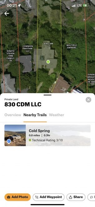
Same as “Premium” level, but also adds in property boundaries, landowner information, and lot information (like area in acres, etc),
Features
The basic feel of the app is simple to use. You can really just pick it up and start playing around with it. You don’t need to get a degree in geographic information systems to figure it out.
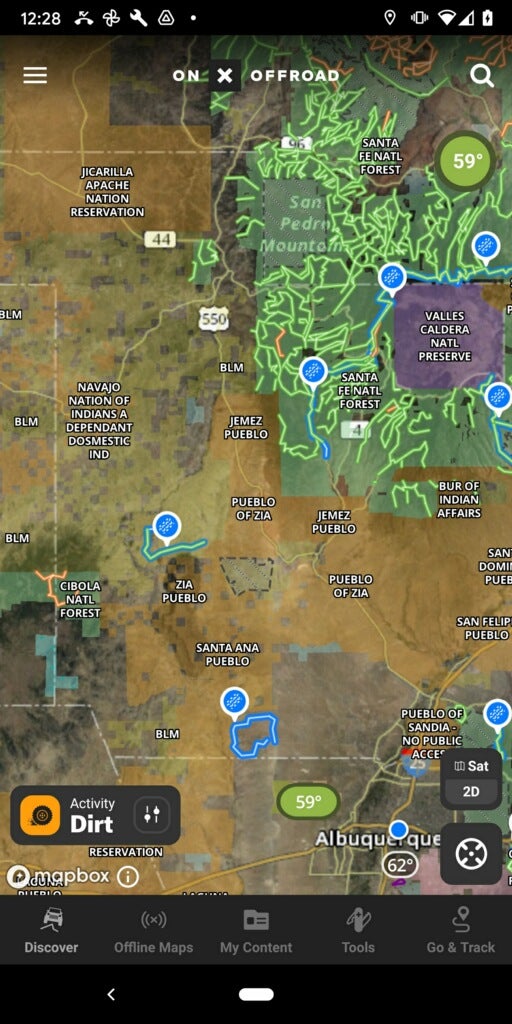
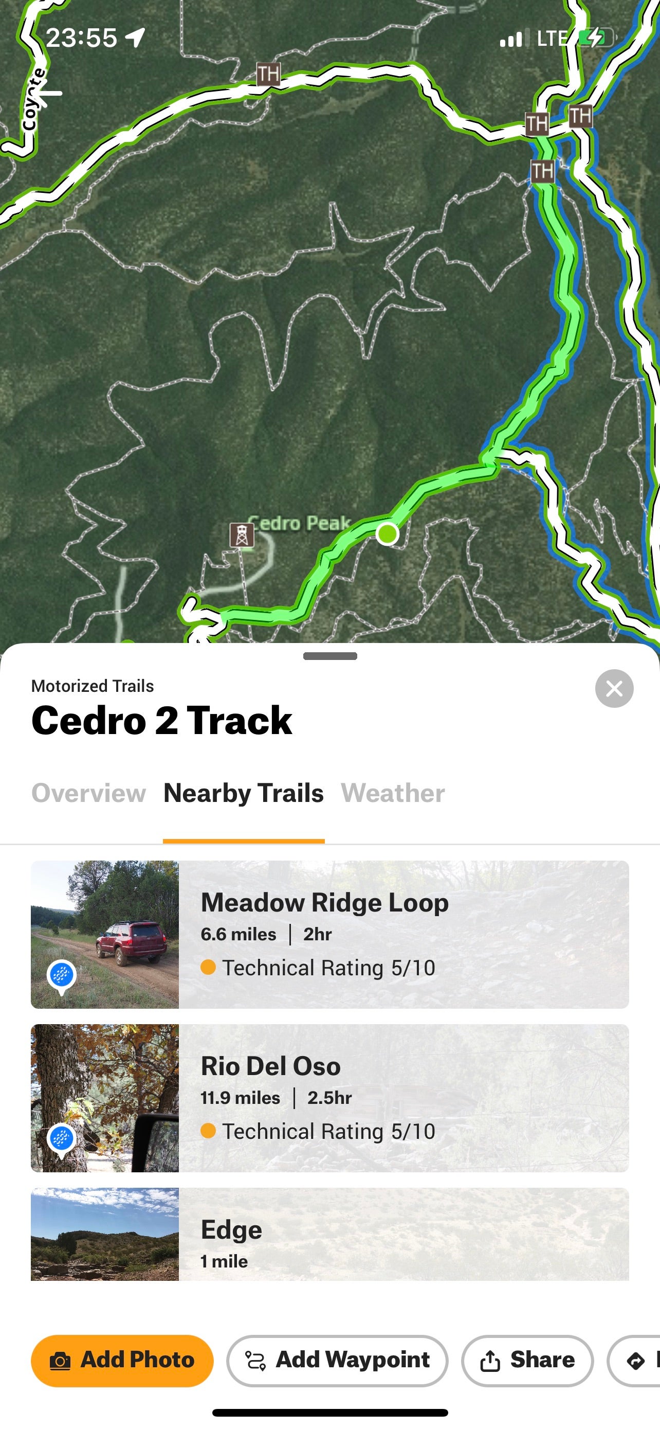
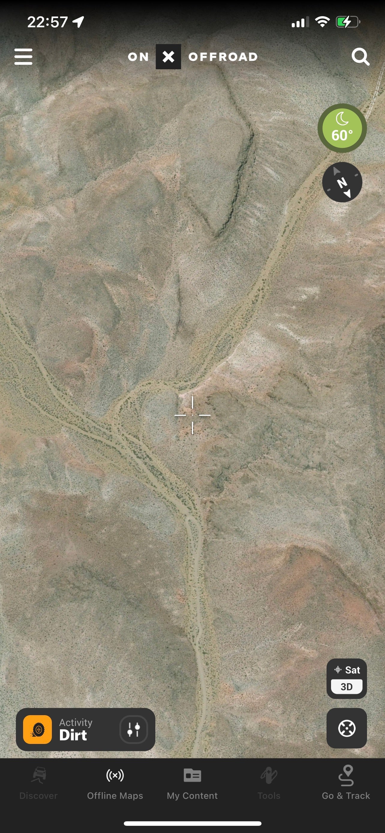
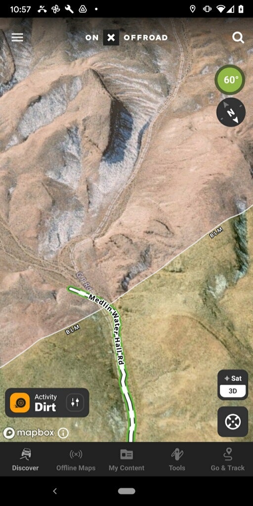
As soon as you open the app, and it fixes your position, it presents you with a view of trails nearby (that are highlighted). Tapping on a trail opens a panel that gives you information about the trail.
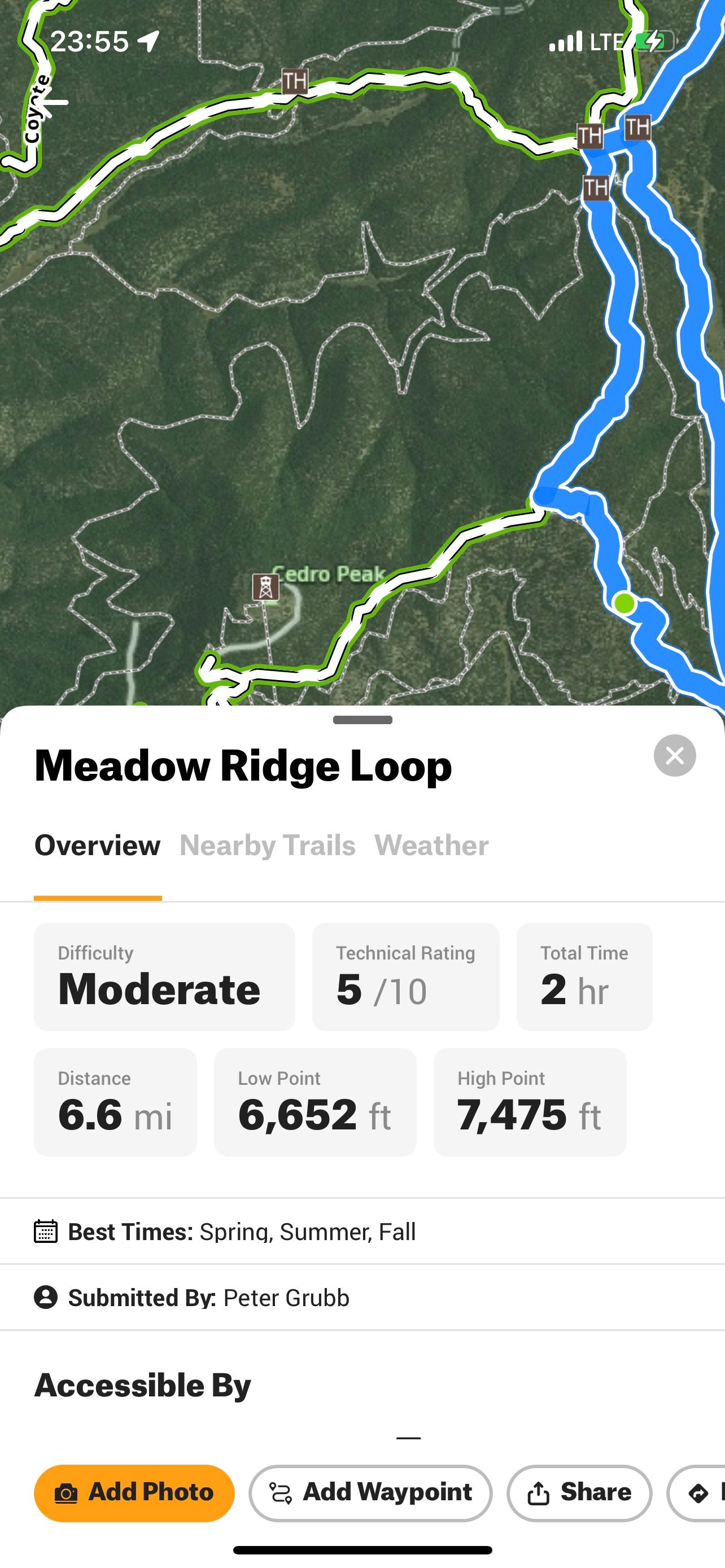
The details of the trail provide an overview with information like difficulty, total time, distance, and elevation low and high points. If the trail has been explored by a Trail Guide (onX supported enthusiasts that help map trails), there might be a write-up and pictures.
You can also find nearby trails. This can be useful if you initially selected a trail outside of your skill level and want to find something in the same area that is more appropriate.
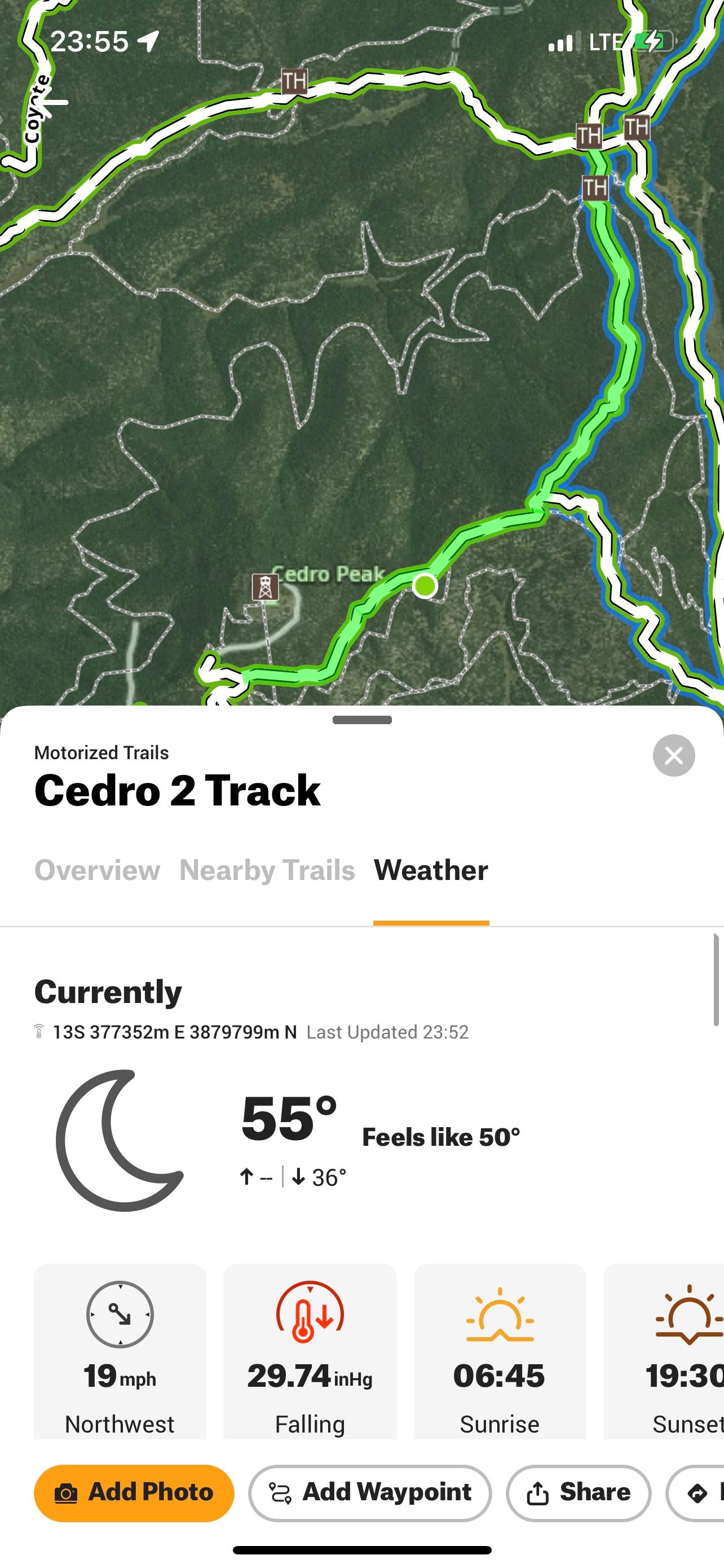
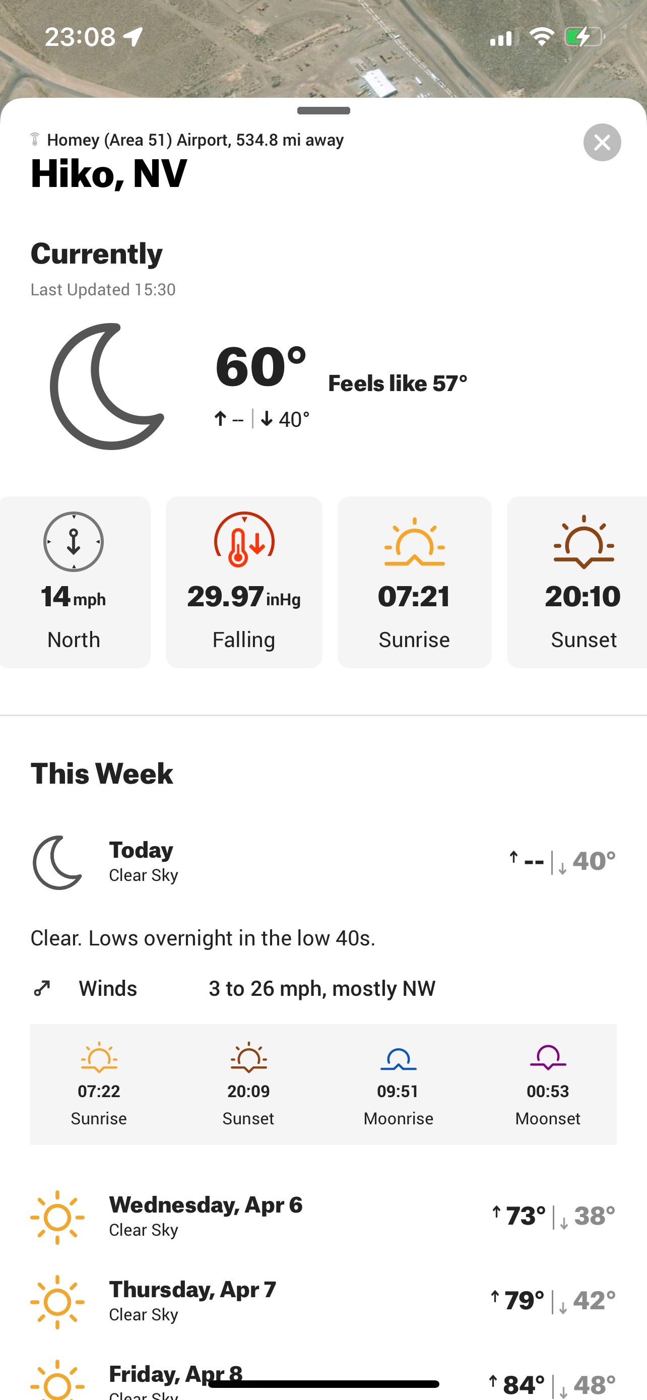
Lastly, there is a tab for weather that will give you conditions at that trail. This can be very helpful when coupled with trail data that indicates a difficulty increase when the trail is wet, and the weather indicates it is currently raining.
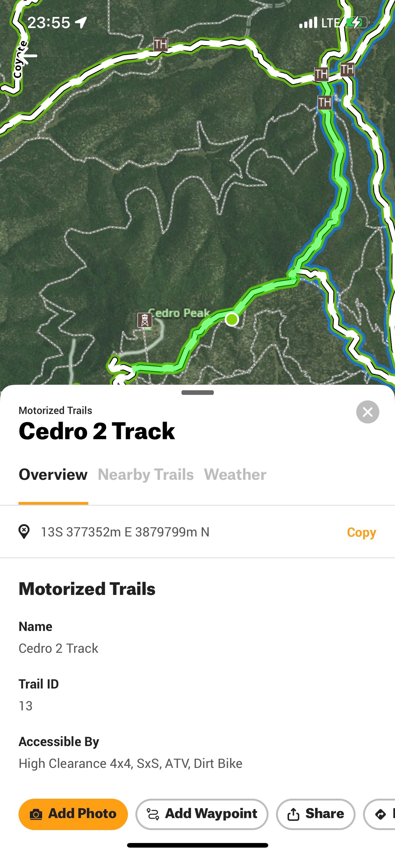
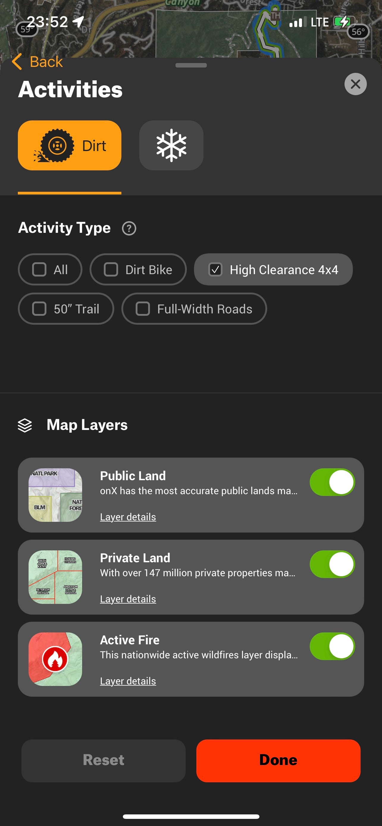
You can filter the display based on a number of factors such as the platform you are driving – dirt bike or high clearance 4-wheel drive. You can also turn on and off layers (based on which plan you are subscribed to). A particularly useful layer is “Active Fire” which can help you avoid areas under closure.
Car Play/Android Auto/Tablet
Most modern vehicles have some form of integration with your smartphone, and there are a ton of aftermarket head units that add this functionality. While you can certainly navigate on the tiny little screen on your phone, it is much nicer (and safer) to use a bigger screen. If you are by yourself, using the version that integrates into the head unit can make life much easier.
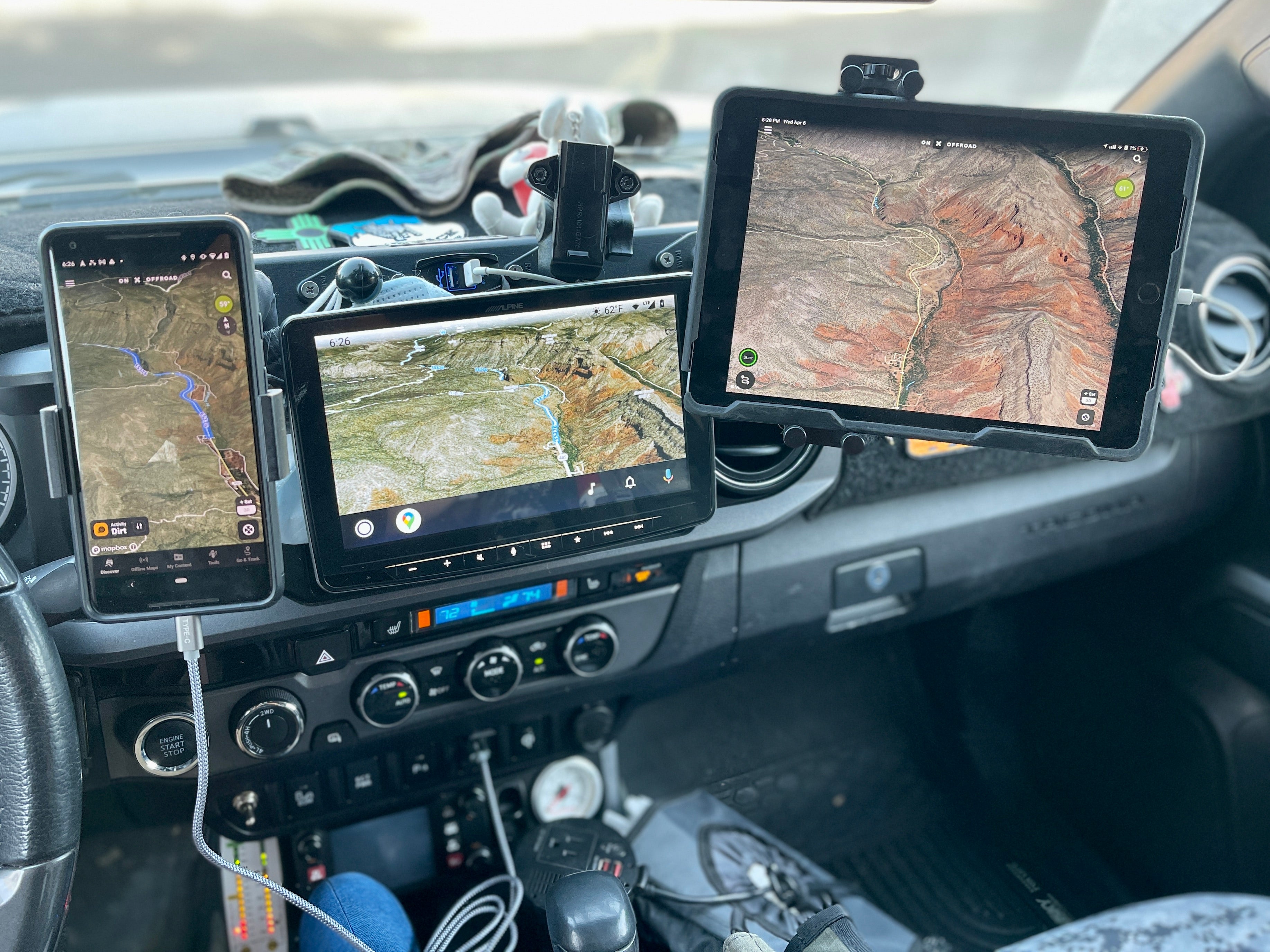
For years I have used an old tablet mounted via RAM mounts as my navigation device (and I generally still use one). I’ve found this to be the overall best solution as it allows my passenger to add waypoints, search locations, and overall, well, navigate. It allows for pairing with an external GPS device for ultra-precise location data. The iOS version has a quirk with forcing portrait mode when accessing the settings (onX is aware and it will be fixed in an upcoming release).
3D Mapping
The 3D mapping feature can be pretty useful when you are trying to scout for camping spots. You can get a pretty good feel for the topography of the area, and if the area is suitable for a site.
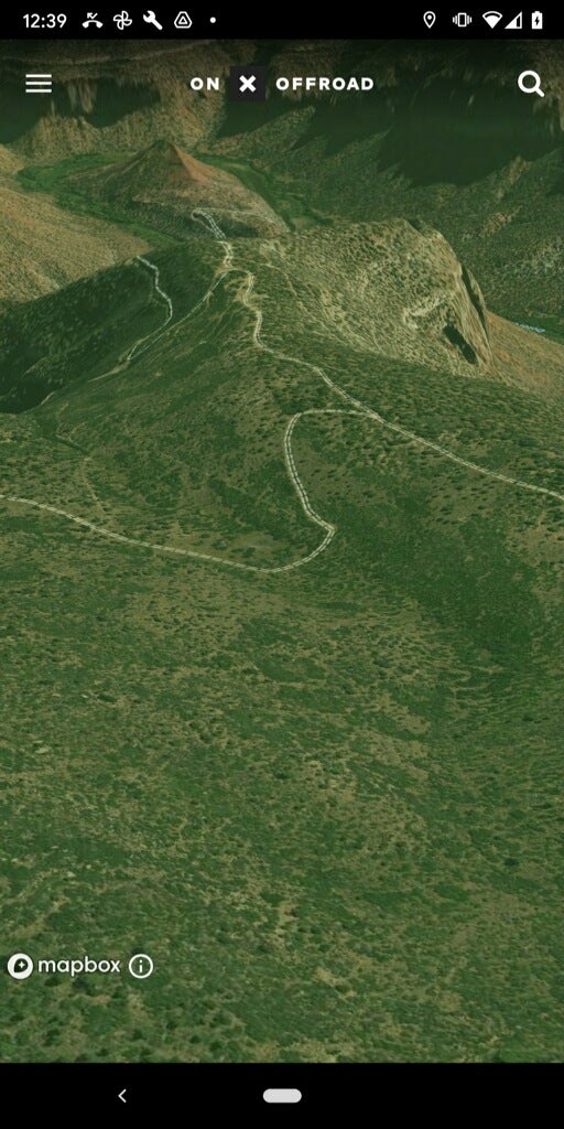
I found the app to be a little inconsistent between the iOS and Android versions (and also, 3D is only available on Android with the Elite plan). Android gave me solid overlays in 3D mode, and I could see land boundaries and highlighted trails. iOS was more limited – I could scroll around and pan/tilt, but lost where I was at. onX said they are working on updating the 3D tech and should have some updates later this year.
Weather
One of my favorite features is being able to get weather data for the area you are inspecting (well, the closest telemetry station anyway).
Offline Maps
Most device navigation software has the ability to save maps for offline use. onX Offroad is no exception. Be aware that the “free” level limits you to one offline map.
Waypoints, tracks, and organization
You can save points, log tracks, and organize them all into folders. This is fairly standard stuff and what you would expect from a navigation app. It has all of the standard features like sharing points and navigating to places.
Tools
One useful feature is the ability to measure line distances on the map, and also to draw a shape and get the area. I’ve used this to roughly measure camping spots that looked tight. I’ve also found myself using it for non-off-road applications like getting the rough area of my backyard when ordering sod.
Conclusion
Despite some minor quirks, onX Offroad has become my go-to off-road navigation app (and this has nothing to do with their sponsorship of this series – I have been using onX products for a couple of years now).
It is easier to use, and I can accomplish my tasks much more efficiently. It definitely behaves more like a native mapping application (with enhancements that improve off-road navigation) and less like an overly complex GIS tool.
If you haven’t tried onX Offroad, give it a shot and let us know your thoughts in the comments.
Off-Road and Overlanding is sponsored by
![]()
To subscribe, visit: https://subscribe.onxmaps.com/offroad/purchase/membership
